Maps are fundamental tools for understanding the built environment. Rather than just representing locations, they allow us to visualize spatial relationships, recognize urban patterns, overlay layers of information, and produce new ways of reading a territory. In architecture, they can help reveal how projects are distributed across cities, identifying which areas concentrate investments or remain on the margins. Furthermore, maps are never neutral: all cartographic representation involves choices—such as data selection, spatial boundaries, and projections used—that can carry political intentions, reinforcing or questioning power structures and worldviews.
In partnership with the platform PLACE, developed by the firm OSPA, ArchDaily Brasil presents an interactive map featuring most of the projects published on the site in recent years. Each point provides information such as images, location, and technical data about the works. The initiative uses exclusively public data available on the platform and includes projects in almost every Brazilian state.
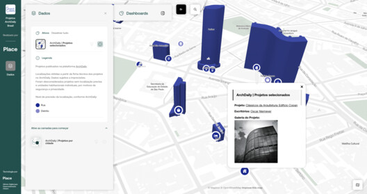
In total, 5,084 projects published on ArchDaily Brasil were considered, 2,971 of which have georeferenced locations. These projects were developed by 1,897 architecture firms across the country. During the data collection process, residential addresses were initially included but were subsequently removed from the map to preserve the privacy of those involved.
Data analysis reveals the diverse scale of the published production. The smallest mapped project, at just 3.95 m², is "the coffee" café by Studio Boscardin.Corsi in Curitiba. At the other end of the spectrum is the Deodoro Olympic Park, spanning 2.5 million m², designed by Vigliecca & Associados in Rio de Janeiro. Other large-scale projects include the urbanization of the Cantinho do Céu Complex, the Guaíba Orla Park, and the Tecnovates Innovation Center, all with areas exceeding 500,000 m².
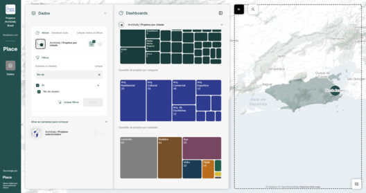
Among the firms with the highest number of published projects are SuperLimão (49), BLOCO Arquitetos (44), FGMF (43), studio mk27 – Marcio Kogan (41), and Studio Arthur Casas (39). The most frequent categories are residential architecture (2,433 projects), followed by commercial (538), educational (407), offices (299), and cultural (257).
The survey also highlights the most commonly used materials: concrete (2,492 projects), wood (1,461), steel (1,037), glass (538), brick (407), and stone (242). Materials like prefabricates and plastics appear in smaller numbers, with 41 and 31 occurrences, respectively. São Paulo leads in the number of geolocated projects (1,332), followed by Brasília (220), Rio de Janeiro (204), Porto Alegre (190), and Curitiba (133).
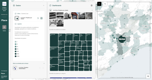
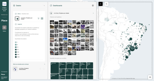
The spatial visualization of these data offers a potential overview of recent Brazilian architectural production—and, consequently, of construction industry dynamics in the country's major capitals. However, it is important to remember that the projects represented on the map constitute only a small fraction of formal production, meaning designs signed by architects and published on the platform. The mapping does not cover the vast amount of construction that makes up the informal architecture market and populates all Brazilian cities.
The interactive map is open for public viewing. Explore the published projects and discover, through cartography, a new way to observe contemporary Brazilian architecture.
This article was written by ArchDaily Team. The translation is powered by AI.